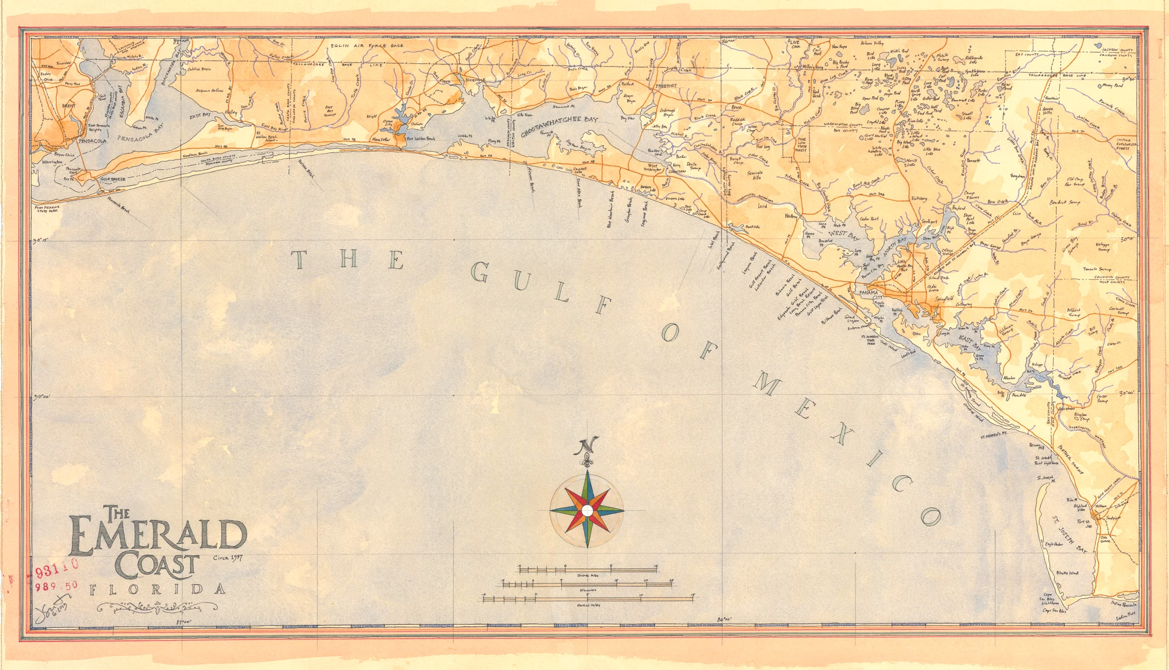
Florida's Emerald Coast-circa 1957
Florida's Emerald Coast-circa 1957
$150.00
Hand-drawn watercolor map of Florida’s gulf coast, also referred to as the Emerald Coast. This map includes the coastline from Indian Pass to Pensacola Beach, circa 1957. This map shows the Tallahassee Base Line, which is not found on newer maps. These “Base Lines” date back as early as 1777 and were originally proposed by Thomas Jefferson, when the Federal government suddenly became responsible for vast areas of land that it needed to sell or give to soldiers,
Quantity:


